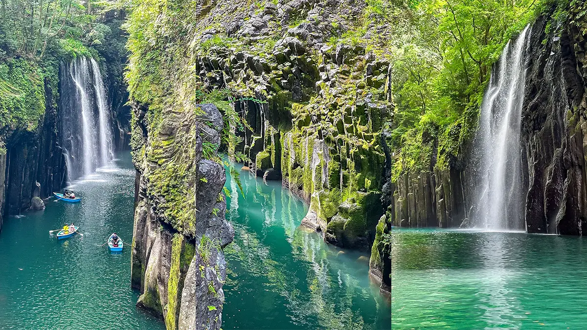
Here is Part 2 of the final day of our trip to Miyazaki and Aso!
After leaving the mystical and breathtaking Takachiho Gorge around noon, we headed toward Aso in Kumamoto Prefecture.
Initially, Aso wasn’t part of our itinerary. The plan was to head back to Miyazaki from Takachiho and fly home from Miyazaki Airport. However, when I took a closer look at the map, I thought, “Wait, isn’t Aso actually pretty close?!” So, we changed our route on the fly.
By the way, Aso is a symbol of Kumamoto, the “Land of Fire,” and Mount Aso is a double volcano. I used to mistakenly think Mount Aso was a single peak, but I was wrong (haha). It doesn’t refer to just one mountain, but rather a group of peaks extending east to west, centered around the Aso Five Peaks (Aso Gogaku): Mt. Taka, Mt. Neko, Mt. Naka, Mt. Eboshi, and Mt. Kishima. Sometimes, the outer rim (caldera) and the basin are also included under the name.
I actually visited Aso about 20 years ago. Back then, I lived in Nagano Prefecture, and I drove all the way to Aso from there! It was a relaxed, spontaneous road trip with several nights sleeping in the car along the way, and Aso was the final destination. When I first arrived, I was completely blown away by the grand scenery. It felt so open and vast, with clear views all around—it just felt amazing. I also remember getting so excited seeing cattle and horses grazing right by the side of the road.
Since my car had Nagano license plates, a few locals asked me, “Did you really drive all the way from Nagano?” When I said yes, they all said the same thing: “Compared to Nagano, Aso probably isn’t all that impressive to you, huh?”
It’s true that the Japan Alps in Nagano are rugged, grand, high-altitude, and much deeper. But honestly, Aso is incredible in its own right! They are completely different types of mountains, so I felt there was no need to compare them. Both are magnificent natural treasures Japan can be proud of.
For this trip, I wanted to show my child the amazing views that had touched my heart back then, so I drove while tracing my vague memories from 20 years ago.
宮崎&阿蘇の旅、最終日のパート2です。
神秘的で美しかった高千穂峡を12時ごろに出発し、熊本県の阿蘇に向かいました。
旅の最初の計画では阿蘇は入れておらず、高千穂からまた宮崎に戻って宮崎空港から帰ってくるつもりでした。
しかし、よくよくちゃんと地図を見てみると、阿蘇、近くない??となり、ルート変更しました。
ちなみに、阿蘇は火の国熊本のシンボルで、阿蘇山は二重火山です。
また、私は阿蘇山という一つの山だと思っていましたが、勘違いでした(笑)
一つの山を指すのではなく、阿蘇五岳を中心にした東西にのびる連山でした。
阿蘇五岳とは高岳、根子岳、中岳、烏帽子岳、杵島岳です。
外輪山や火口原を含めて呼ぶこともあるそうです。
実は私は20年くらい前に阿蘇に来たことがあります。
当時は長野県に住んでいたのですが、その長野県からはるばる車で来ました。
途中何度も車中泊をしながら、のんびり気ままなドライブ旅行で、阿蘇は最後の目的地でした。
初めて阿蘇に着いた時はその雄大な景色に感動しました。
広々していて、割と視界が開けていて、とっても気持ちが良かったです。
道のすぐ横で牛や馬を放牧している様子にも、テンションが上がりました。
車が長野ナンバーだったので、「本当に長野から車で来たの?」と何人かの地元民に聞かれました。
そうだと答えると、「長野に比べちゃうと阿蘇なんて大したことないね。」と、皆さん同じことを言ってきました。
確かに長野の日本アルプスは険しく雄大で、標高も高いし、山がもっともっと深いです。
でもね、阿蘇だって凄いですよ。
というか、同じ山でも日本アルプスとは全く別のタイプの山なので、比べる必要なんてないかなと思いました。
どちらも日本の誇るべき山たちです。
今回の旅行でも、私が感動した景色を子供に見せてあげたいと思い、20年前の薄っすらした記憶を辿りながらドライブしてみました。
- 12:00Leave Takachiho Gorge
- 14:00Kusasenrigahama Grassland
- 14:50Lunch at Kusasenri
- 15:15Mt. Aso Nakadake Crater
- 16:30Yoshiichi Ranch
- 18:00Returning the Rental Car to Times Car Rental
- 20:30Leave Kumamoto Airport
- 22:15Arrive at Haneda airport
From Takachiho Gorge, we took Route 325 toward Aso, aiming first for Kusasenrigahama.
Taking Route 111 along the way would have been the shorter option, but I wanted to show my child Kometzuka—a charming, bright green volcanic cone—so we kept going straight. We turned right onto Route 299, and then right again when it hit Route 298. This route kept Kometzuka on our left.
As we drove, I pointed it out—”Look, there it is!”—for a quick sightseeing moment from the car. Because of that, I totally forgot to take a photo…
高千穂峡から国道325号線で阿蘇方面に向かい、まずは草千里ヶ浜を目指しました。
途中で111号線に右折するルートの方が近いのですが、米塚という可愛らしい緑の山を見せたかったので、そのまま直進。
299号線を右折し、298号線にぶつかったらまた右折して米塚を左手に見るルートを取りました。
車を走らせながら、米塚が出てきたら「ほら、あれだよ!」と車中観光。
そのため写真は撮り忘れました・・・
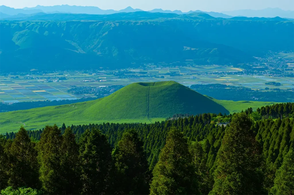
Looking back, I really regret not pulling over to snap a picture of such a cute mountain! So, I borrowed this photo from stock images instead.
See? Isn’t it adorable?
でも、あんな可愛い山、ちゃんと停まって撮影すればよかったと後で後悔。
なので、こちらはストックフォトから拝借です。
ね?可愛いでしょ?
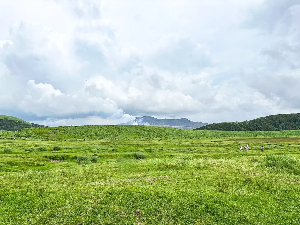
Here is Kusasenrigahama.
It’s a famous scenic spot with a massive grassland covering roughly 785,000 square meters and a large pond.
The paid parking lot costs 500 yen per day for a standard passenger car (as of August 2026).
First, we took a stroll around the grassland near where we parked. We could see steam rising from the volcanic crater in the distance (around the center of the photo).
After that, we intended to head toward the pond, but since it was already 2:00 PM and we hadn’t eaten lunch yet, my child started getting cranky from hunger. So, we headed straight for the restaurants instead. To my utter embarrassment, we completely forgot to go back and check out the pond afterwards…
草千里ヶ浜です。
約78万5,000平方メートルの広い草原と大きな池がある有名な絶景スポットです。
有料駐車場は普通車で一日500円(2026年8月現在)です。
まずは駐車した場所から近かった草原を散策。
火口から湯気が出ているのが見えました。(写真の真ん中らへん)
その後、池の方向に行こうと思いましたが、すでに14時なのにまだ昼食を食べていなかったため、子供が空腹で騒ぎ出し、レストランに向かうことに。
そして、不覚にも池はそのまま行き忘れてしまいました・・・
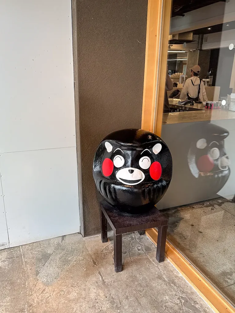
This photo shows a Daruma doll version of Kumamoto’s mascot, Kumamon, which was sitting right at the shop’s entrance. Pretty cute, right? Bringing home one this size would be impossible, but a small keychain or mascot-sized version would make a great souvenir!
Don’t worry about food when visiting Kusasenri, though—there are plenty of restaurants and cafes lined up right across from the parking lot. We stopped by Kusasenri Shokudo, enjoyed some local Kumamoto ramen, and discussed our next stop.
After our discussion, we decided to head to the crater of Mt. Naka next.
When planning the trip, the official Aso Volcanic Crater Regulation website had shown a warning: “Volcanic Crater Warning (Eruption Alert Level 2) is currently active. Entry within approximately 1 km of the crater is prohibited.”
Because of this, I had given up on seeing the crater. But when I checked again while at the restaurant in Kusasenri, to my surprise, the restriction had been lifted just two days prior! We got so lucky.
The Mt. Naka crater is extremely easy to access—it’s just a short walk from the nearest parking area, so no hiking or trekking is required.
Viewing the crater and using the parking area itself is free, but since you have to take the Aso Toll Road to reach the parking lot, it costs 1,000 yen for a standard passenger car (as of August 2026).
写真は熊本県のマスコットキャラクター、くまモンのダルマ版。お店のエントランスにありました。
結構可愛いです。こんなに大きいのは無理ですが、キーホルダーやマスコットサイズの小さいのならお土産に良いかもしれません。
草千里は駐車場に面して、レストランやカフェが並んでいるので、お食事には困りませんよ。
私たちは草千里食堂に入り、熊本ラーメンを食べながら次の目的地の相談をしました。
相談の結果、次の目的地は中岳の火口になりました。
旅の計画時は阿蘇山火山火口規制情報サイトに、「火口周辺警報(噴火警戒レベル2)発表中のため火口から概ね1kmの範囲内の立ち入りは禁止です。」と表示されていました。
そのため火口見学は諦めていましたが、レストランで再度調べたら、なんと2日前に解禁していました。ラッキーでした。
中岳火口は直近の駐車場から歩いてすぐのため、登山やトレッキングの必要がなく、とても楽にアクセスできます。
火口見学と駐車場は無料ですが、駐車場までは阿蘇山公園有料道路を通らないといけないため、普通車だと1000円(2026年8月現在)の通行料金がかかります。
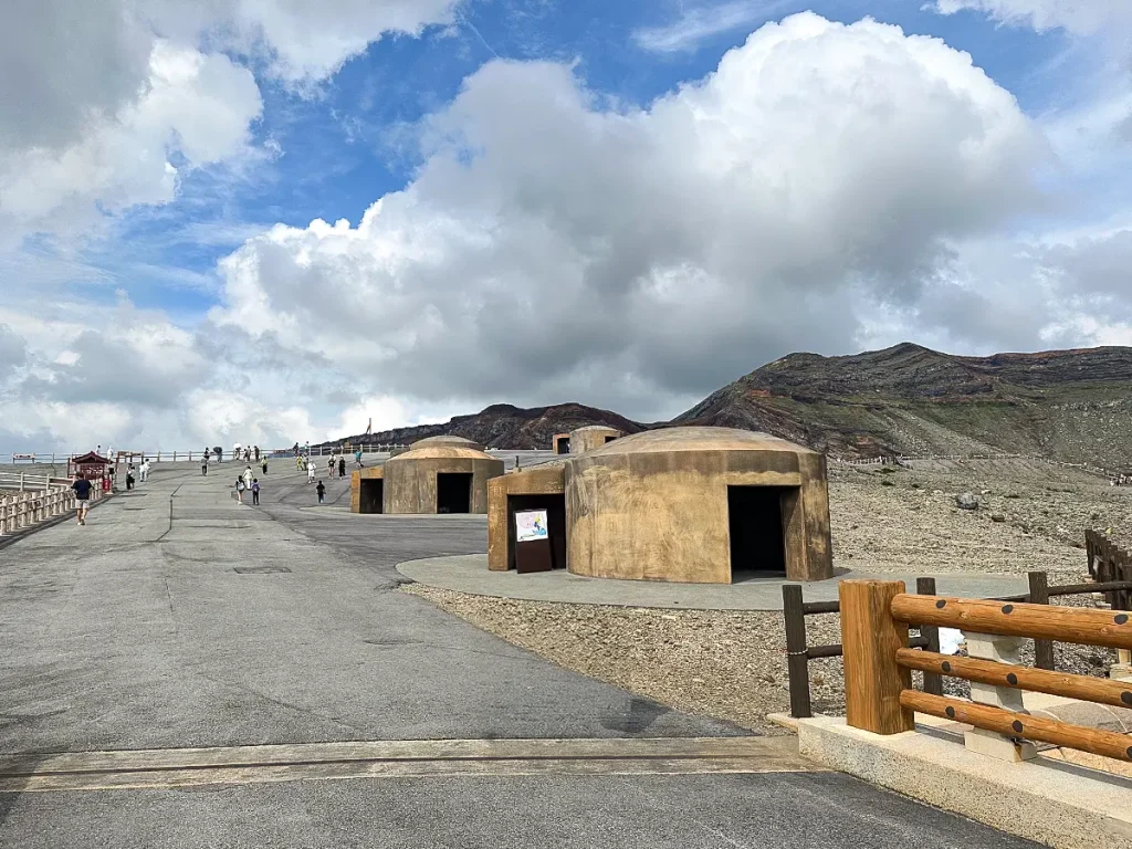
Between the parking lot and the crater, there are several volcanic shelters.
駐車場から火口までの間に、火山シェルターがいくつもあります。
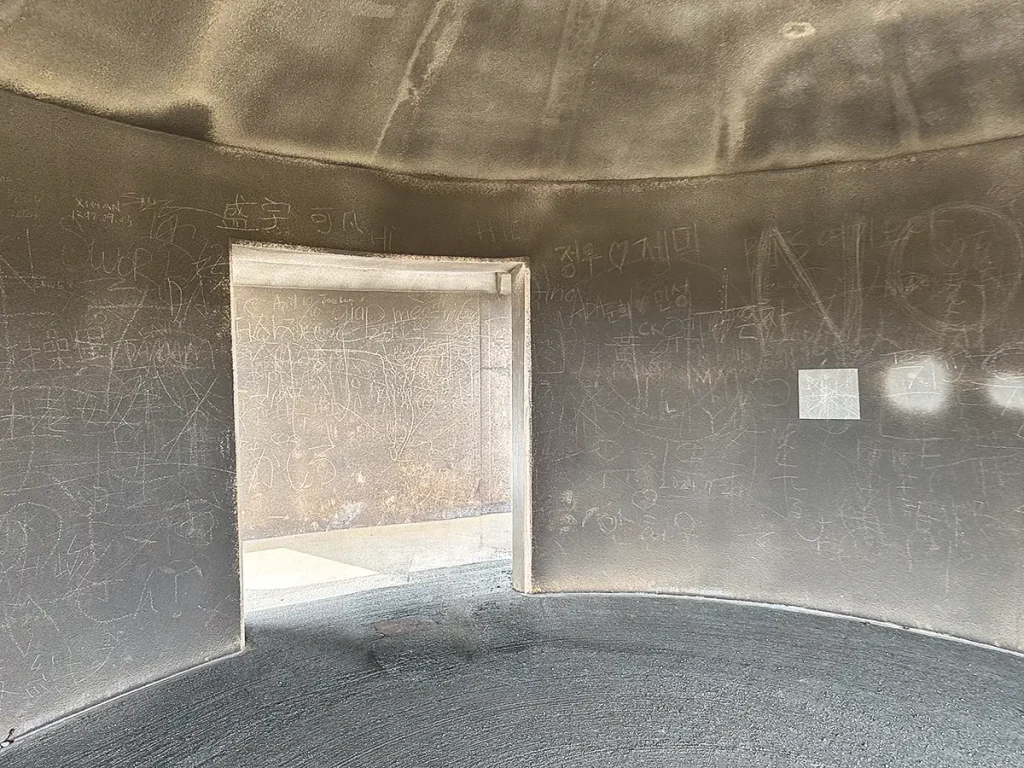
I stepped inside one of the shelters—it was covered in graffiti!
シェルターの中に入ってみました。
落書きだらけです。
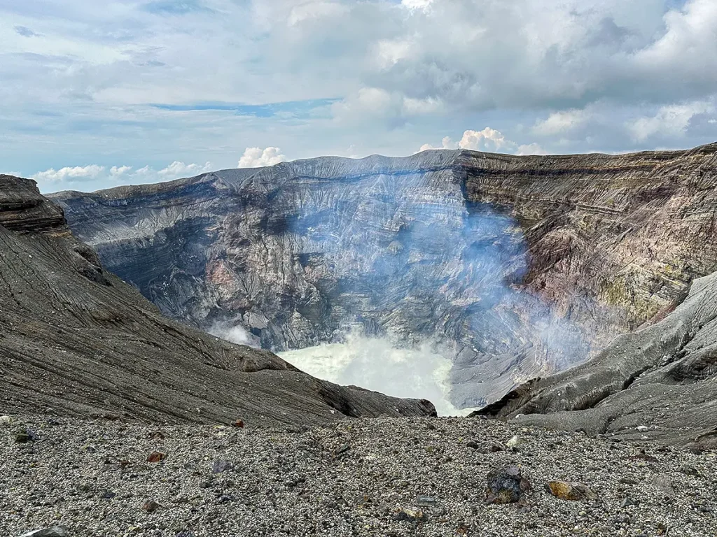
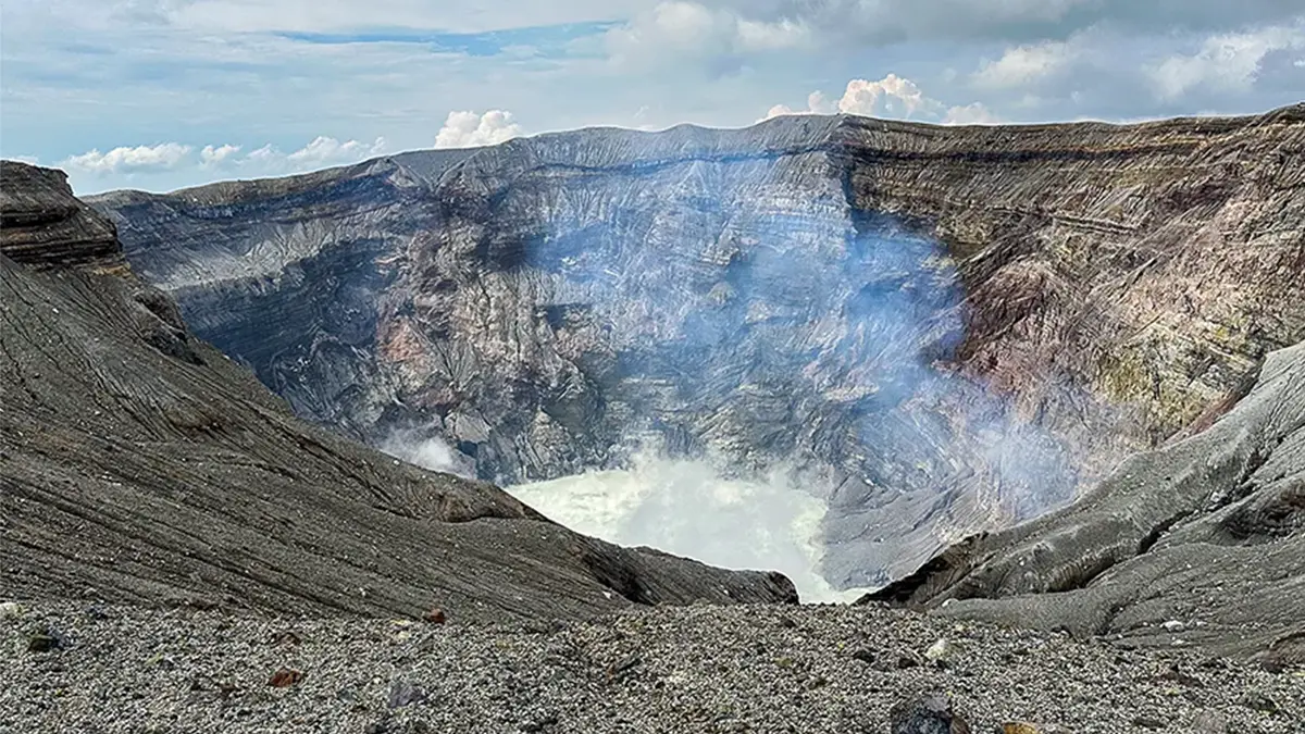
And here is the crater itself.
火口です。
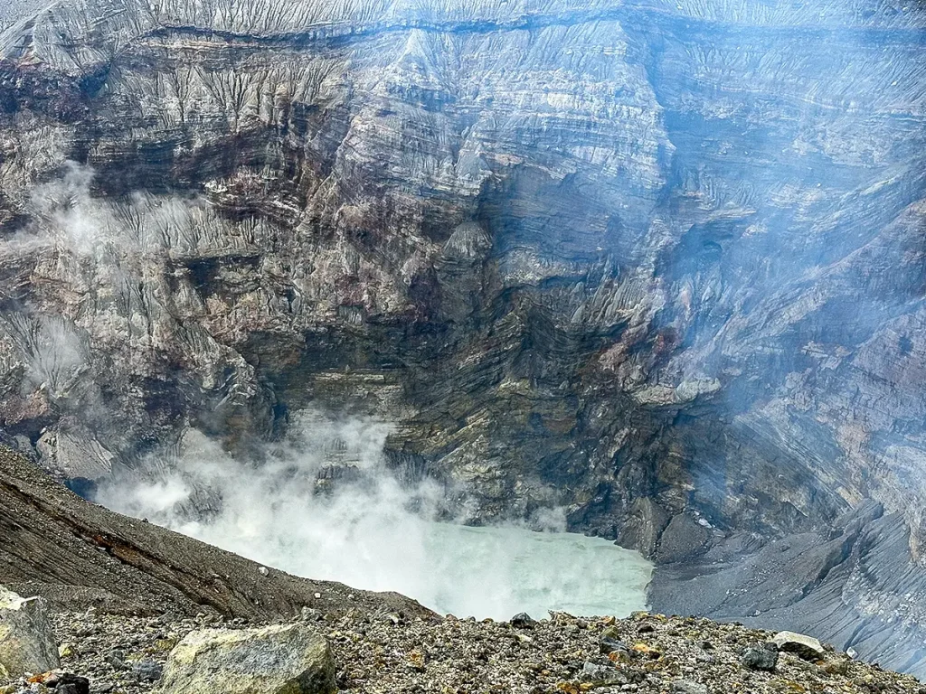
You can really see the impressive layers here.
Unfortunately, the crater lake water wasn’t the signature emerald green, but it was still incredibly powerful and intense.
Apparently, when volcanic activity picks up, the water turns from green to gray. Since the Eruption Alert Level 2 had been active until just two days ago, it was probably leaning toward gray. A bit of a shame, but still amazing.
Even so, imagining what would happen if you fell in gives you a bit of a chill!
地層がよく見えますね。
残念ながら湯だまりはエメラルドグリーンではありませんでしたが、迫力すごい。
火山活動が活発になると湯だまりの色が緑から灰色に変化していくそうです。
今回は二日前まで噴火警戒レベル2だったからグレー寄りなのでしょう。ちょっと残念。
それにしても、転げ落ちたらどうなるのだろう?と想像するとちょっと怖いですね。
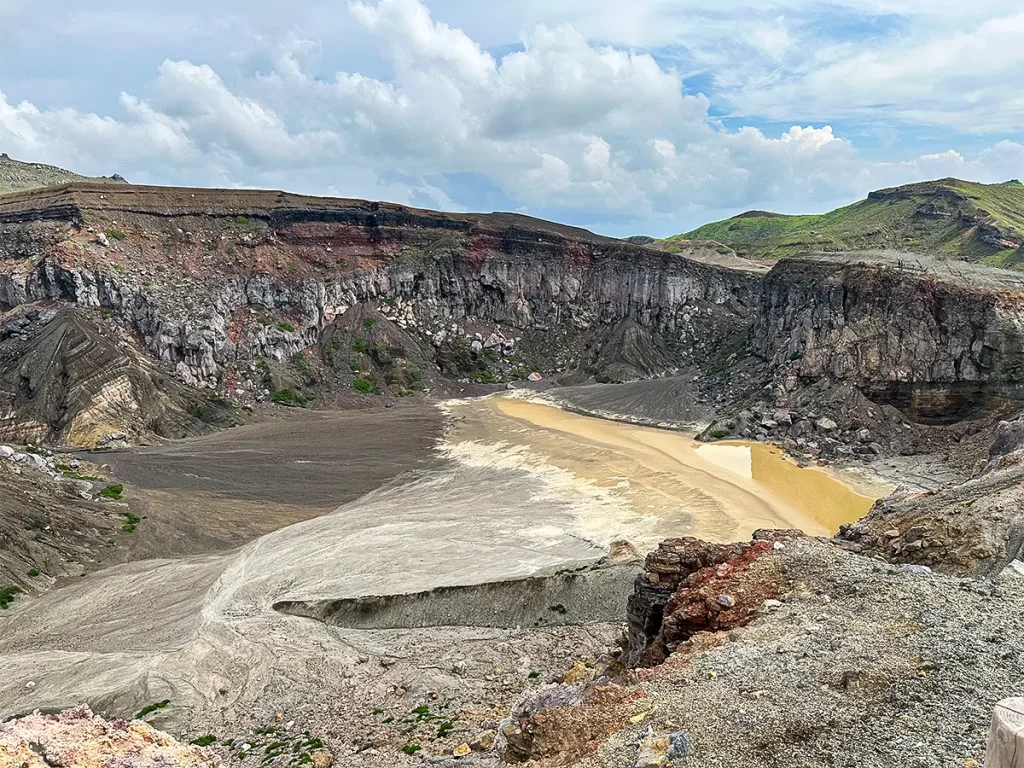
Here is the scenery around the crater.
火口周辺の景色です。
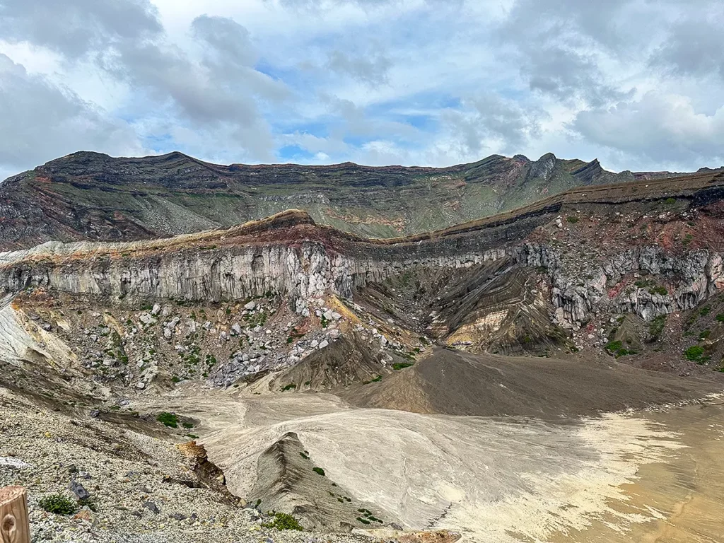
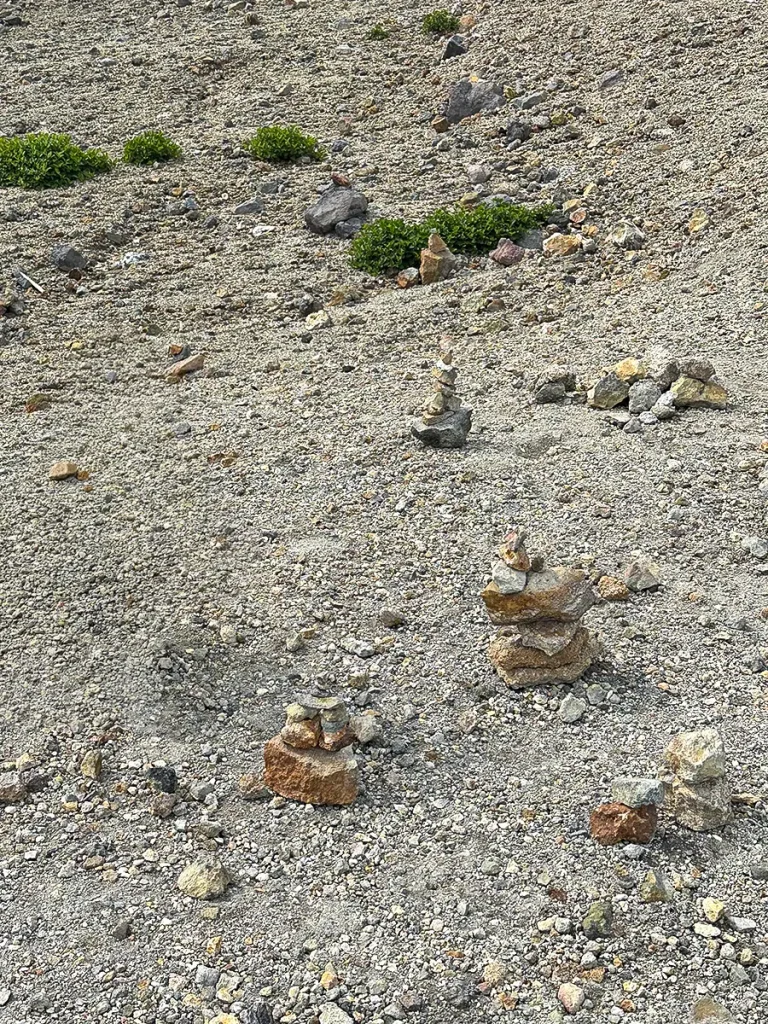
It seems like a lot of kids enjoy stacking up small stones around here, which created a whole zone of improvised rock sculptures. Naturally, my child jumped right in and started building one too. Monkey see, monkey do—that’s probably how this whole area came to be!
My mother-in-law absolutely loved the crater. Even after returning home, she keeps mentioning how great it was.
It really is a powerful sight—you can see the geological layers clearly, and the surrounding scenery is magnificent. Anyone interested in geology would probably enjoy it even more!
After viewing the crater, we headed toward the area where cattle and horses graze.
We looped back from the crater toward Kusasenri and took Route 111 where Route 298 and Route 111 split.
As we kept driving, it came into view—the exact grazing scenery that had thrilled me 20 years ago!
I checked Google Maps, and it turned out to be Yoshiichi Farm.
このように小さな石を積み上げて遊ぶ子供が多いみたいで、即席オブジェ地帯が出来上がっていました。
当然うちの子も真似して作っていました。
真似が真似を呼び、こうなったのでしょう。
お姑さんは火口をとっても気に入っていました。
帰ってからも、凄く良かったと何度も言っています。
確かに大迫力だし、地層も見れるし景色も抜群です。
地質学に詳しい人とかは、もっと楽しめそうですね。
火口見学後は牛や馬を放牧している辺りを目指しました。
火口から草千里方面に戻り、298号線と111号線が分岐するところで111号線に進みました。
そのまま進むと見えてきました。
20年前に私がテンション上がった放牧風景です。
Googleマップをチェックしてみたら、どうやら吉一牧場っぽいです。
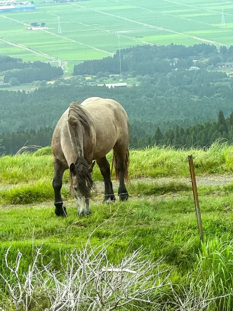
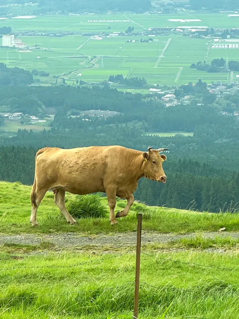
These top three photos were taken by my child from the passenger seat. Pretty good shots, right?
上3枚は助手席から子供が撮った馬と牛。
なかなか上手く撮れてます。
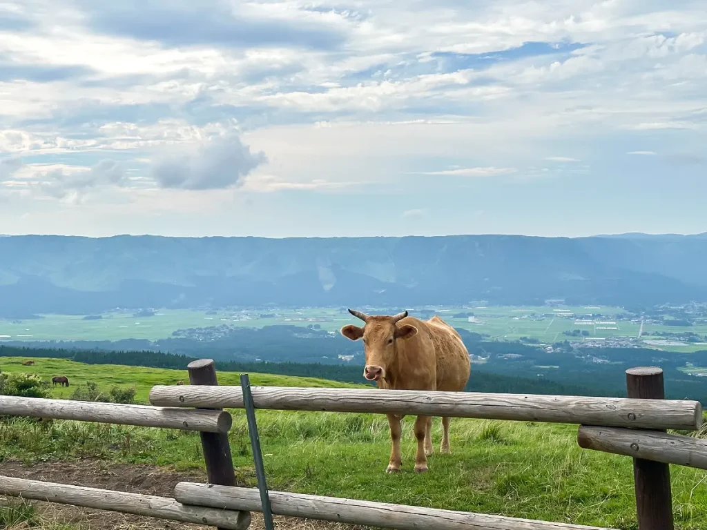
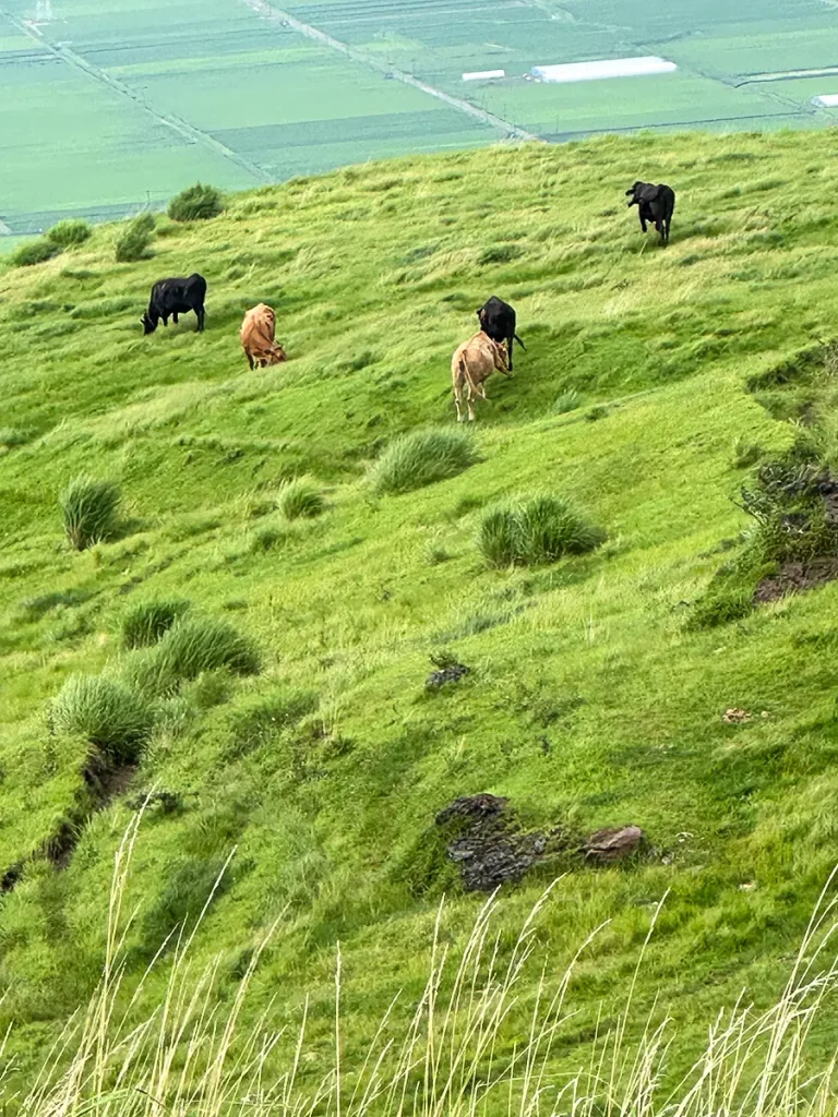
This one was taken by me after I pulled the car over and got out.
I was so happy to finally show my child the scenery I had been dreaming of sharing.
…However, my child’s reaction?
“Meh, it’s alright, I guess?”
It was a much milder reaction than I expected—such a contrast to my own excitement!
After that, we headed toward Kumamoto Airport.
Kumamoto Airport was surprisingly impressive, with plenty of shops and restaurants. It seems like Kumamoto and Fukuoka are the standout airports in Kyushu, which makes sense given how many passengers they handle.
We flew with JAL on the way there, but booked ANA for the flight back.
We originally booked economy seats with ANA, but upgraded because a meal was served on board. For drinks, alcoholic beverages were available, so I ordered sparkling wine. I was so tired that I forgot to take a photo, though!
This whole itinerary felt pretty packed and busy for a 2-night trip. I don’t know if we’ll ever be able to go back, but next time, I’d love to take my time and explore it even more thoroughly.
これだけ車を停めて降りた後に、私が撮影。
見せたかったこの風景を無事に見せることができました。
が、しかし、子供の反応は。
「まあ、いんじゃない?」ですって・・・
思ったよりも薄い反応で、私とは大違いでした。
その後は熊本空港方面に向かいました。
熊本空港はお店やレストランが多く、結構立派でした。
九州では熊本と福岡空港が立派みたいですね。
利用客が多いですからね。
行きはJALでしたが、帰りはANAを予約しました。
ANAは最初普通席を予約していましたが、機内食が出るのでアップグレードしました。
ドリンクはアルコールも選べたので、スパークリングワインを頼みました。
疲れていたので、写真を撮るのを忘れてしましました。
この行程は2泊だとパツパツで結構忙しかったです。
また行けるかわからないけれど、今度はもっとじっくり周りたいなと思います。